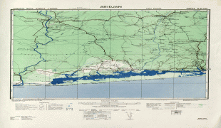
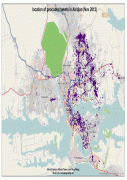
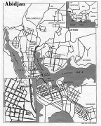
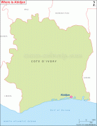
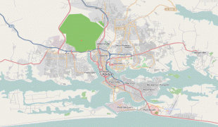
Abidjan
 |
The city expanded quickly after the construction of a new wharf in 1931, followed by its designation as the capital city of the then-French colony in 1933. The completion of the Vridi Canal in 1951 enabled Abidjan to become an important sea port. Abidjan remained the capital of the Ivory Coast after its independence from France in 1960. In 1983, the city of Yamoussoukro was designated as the official political capital of Ivory Coast.
However, Abidjan has officially been designated as the "economic capital" of the country, because it is the largest city in the country and the centre of its economic activity. Also almost all political institutions and foreign embassies continue to be located in Abidjan. The Abidjan Autonomous District, which encompasses the city and some of its suburbs, is one of the 14 districts of Ivory Coast.
According to oral tradition of the Tchaman as reported in the Encyclopedic Dictionary of Côte d'Ivoire, the name "Abidjan" results from a misunderstanding. Legend states that an old man carrying branches to repair the roof of his house met a European explorer who asked him the name of the nearest village. The old man did not speak the language of the explorer, and thought that he was being asked to justify his presence in that place. Terrified by this unexpected meeting, he fled shouting "min-chan m'bidjan", which means in the Ébrié language: "I just cut the leaves." The explorer, thinking that his question had been answered, recorded the name of the locale as Abidjan.
A slightly different and less elaborate version of the legend: When the first colonists asked a native man the name of the place, the man misunderstood and replied "M'bi min djan": "I've just been cutting leaves".
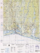
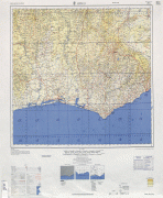
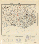
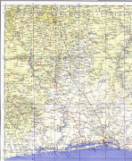
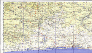
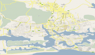
Map - Abidjan
Map


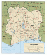
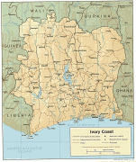

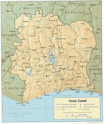
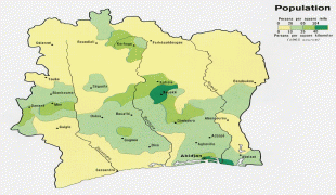
Country - Côte_d'Ivoire
 |
 |
| Flag of Ivory Coast | |
Before its colonization by Europeans, Ivory Coast was home to several states, including Gyaaman, the Kong Empire, and Baoulé. The area became a protectorate of France in 1843 and was consolidated as a French colony in 1893 amid the European Scramble for Africa. It achieved independence in 1960, led by Félix Houphouët-Boigny, who ruled the country until 1993. Relatively stable by regional standards, Ivory Coast established close political-economic ties with its West African neighbours while maintaining close relations with the West, especially France. Its stability was diminished by a coup d'état in 1999, then two civil wars—first between 2002 and 2007 and again during 2010–2011. It adopted a new constitution in 2016.
Currency / Language
| ISO | Currency | Symbol | Significant figures |
|---|---|---|---|
| XOF | West African CFA franc | Fr | 0 |
| ISO | Language |
|---|---|
| FR | French language |